When forming a communication plan, Line of Sight (LOS) is critical for placement of infrastructure. RF communications specifically. While browsing the internet, I found a few decent tools that helped establish what elevation was between to points. For example, for the longest time I used https://www.scadacore.com/tools/rf-path/rf-line-of-sight/ as a tool to help find elevation in and LOS. It truly is a great tool for its purpose and I have to give credit to them for developing it. It has helped me many times.
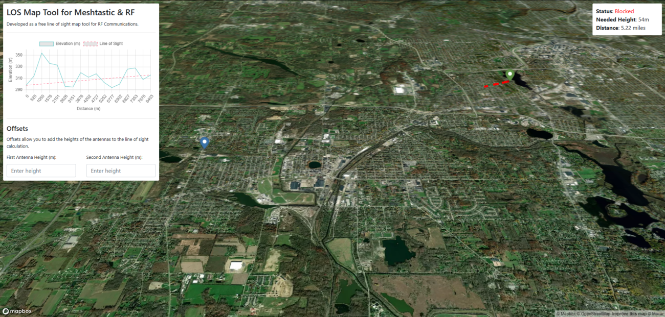
When it comes to a more in-depth tool, the options to choose from are slim. Being a software engineer, I always say that the best way to get a solid understanding of something is to try your hand at it. This is why I started to build out my own tool with a different take on just plotting two points. I wanted something that would also provide a more complex toolset to help establish the best locations for LOS between two points.
Getting Started. If you want to play around with this the tool, it can be found at https://thedirtygrunt.com/tools/losmaptool/.

Features
- Plot two points on the map and get the elevation points between the two points.
- Allows for antenna height offsets for more accurate calculations.
- Simple “Blocked” or “Open” status
- If LOS is bad, it provides the height needed to get LOS between the two points.
- Provides the distance between the two points.
- 3D Mapping
You are free to use the tool as you please. Any and all feedback is welcome!
Enjoy.


Leave a Reply